Wednesday, July 13, 2011
Miles 62.36 Total 3,856.29 Daily Avg. 70.11Avg. Speed 14.1
Max Speed 32.1 mph Alt Climbed 2628 ft
Max Speed 32.1 mph Alt Climbed 2628 ft
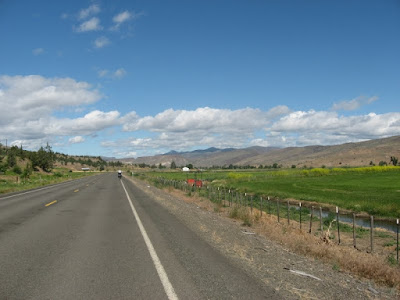
Last night we camped at a state campground in Mount Vernon along Route 26. Today’s ride took us through Picture Gorge along the John Day River. This was a 2% grade as we rode through steep rock walls for 5 miles and turned south from the John Day River. The landscape changed to a more arid rocky desert terrain. Gone were the lush pastures and irrigated farmland we saw long the John Day River, 30 miles behind us.
At 30 miles we arrived at the town of Dayville and took a short break before starting the 20 mile approach and climb to the summit of Keyes Creek Pass, 4,357 ft. Once at the summit it was a 6 mile downhill coast to Mitchell.
The town of Mitchell was almost destroyed on July 11, 1904 when a sudden cloudburst over the desert above us resulted in a wave of water 30 feet high; it rushed down the narrow ravine in which part of the town is located. With the exception of a handful of buildings, the entire town was destroyed. A restaurant, general store, and a city park, where we are camping tonight still exist.
 |
| Prairie City |
 |
| Ride out of Mount Vernon |
 |
| Coming out of the Gorge |
 |
| Picture Gorge |
 |
| Picture Gorge |
 |
| Mitchell, OR |
No comments:
Post a Comment